Interactive Correction of a Distorted Street-View Panorama for Efficient 3-D Façade Modeling
Abstract
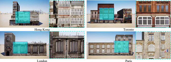
Façade features are important in large-scale level-of-detail 3 (LoD-3) reconstruction in urban environments, and street-view panoramas are arguably the best option for detailed 3-D façade modeling. However, despite the plethora of street-view panoramas available, few studies have explored the metric capabilities of panoramas. This is due in part to the complexities of system integration and in part to problems associated with projection (e.g., distortion at the tops of buildings), and deformation (e.g., the bending of straight structures). In an effort to solve these problems, this letter introduces a flexible and practical solution using only a single panorama. The key is to efficiently rectify panoramas using image-space line constrained deformation inspired by the as-rigid-as-possible deformation of surface meshes. The image is then re-projected using gnomonic projection on a properly selected tangent plane. The proposed approach requires a reasonable amount of user interaction to select and position the vertical line segments. The tangent point is also chosen empirically for each panorama. The rectified images can then be imported into off-the-shelf 3-D modeling solutions as reference images for interactive sketching. Experimental evaluations reveal the effectiveness of the image-space rectification: after proper scaling, the semantic-aware 3-D façade models achieve decimeter-level accuracy with respect to the reference surface mesh.
Publication
IEEE Geoscience and Remote Sensing Letters