Road Extraction from VHR Remote-Sensing Imagery via Object Segmentation Constrained by Gabor Features
Abstract
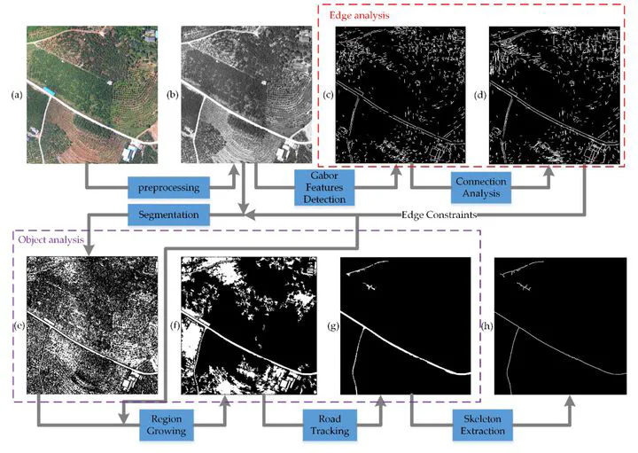
Automatic road extraction from remote-sensing imagery plays an important role in many applications. However, accurate and efficient extraction from very high-resolution (VHR) images remains difficult because of, for example, increased data size and superfluous details, the spatial and spectral diversity of road targets, disturbances (e.g., vehicles, shadows of trees, and buildings), the necessity of finding weak road edges while avoiding noise, and the fast-acquisition requirement of road information for crisis response. To solve these difficulties, a two-stage method combining edge information and region characteristics is presented. In the first stage, convolutions are executed by applying Gabor wavelets in the best scale to detect Gabor features with location and orientation information. The features are then merged into one response map for connection analysis. In the second stage, highly complete, connected Gabor features are used as edge constraints to facilitate stable object segmentation and limit region growing. Finally, segmented objects are evaluated by some fundamental shape features to eliminate nonroad objects. The results indicate the validity and superiority of the proposed method to efficiently extract accurate road targets from VHR remote-sensing images.
Publication
ISPRS International Journal of Geo-Information