Planetary3D: A Photogrammetric Tool for 3D Topographic Mapping of Planetary Bodies
Abstract
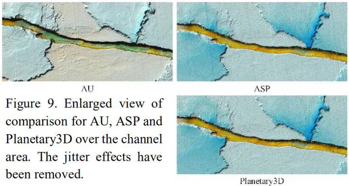
Planetary remote sensing images are the primary datasets for high-resolution topographic mapping and modeling of the planetary surfaces. However, unlike the mapping satellites for Earth observations, cameras onboard the planetary satellites generally present special imaging geometries and configurations, which makes the stereo photogrammetric process difficult and requires a large number of manual interactions. At the Hong Kong Polytechnic University, we developed a unified photogrammetric software system, namely Planetary3D, for 3D topographic mapping modeling of various planetary bodies using images collected by various sensors. Planetary3D consists of three modules, including: (1) the pre-processing module to deliver standardized image products, (2) the bundle adjustment module to alleviate the inconsistencies between the images and possibly the reference frame, and (3) the dense image matching module to create pixel-wise image matches and produce high quality topographic models. Examples of using three changeling datasets, including the MRO CTX, MRO HiRISE and Chang’E-2 images, have revealed that the automatic pipeline of Planetary3D can produce high-quality digital elevation models (DEMs) with favorable performances. Notably, the notorious jitter effects visible on HiRISE images can be effectively removed and good consistencies with the reference DEMs are found for the test datasets by the Planetary3D pipeline.
Publication
ISPRS Annals of Photogrammetry, Remote Sensing and Spatial Information Sciences